 IHS
IHSBuildings
Schools
Listed Buildings
House Names, Field Names and Road Names
Landscape
The Domesday Book records that Hinge Pene consisted of two areas
of land that had been granted by King Alfred to two 'thegns' or
freemen, and that the population and assets consisted of 10
villagers and 15 small holders with 7 ploughs, 20 slaves and a mill,
covering a total area of about 600 acres. Early records show that in
931 a certain Wulfgar had left his land at Inkpen to his wife Aeffe.
At her death, the land was to pass to the 'holy place at Kintbury,
for masses for the souls of Wulfgar, his father Wulfric and his
grandfather Wulfrere, who had all owned the land.
By 1086, after the Norman Conquest, the manor had passed to William
Fitz Ansculf. Before 1100, it had passed to the Paganel, or Paynel,
family. Shortly thereafter, the manor was divided into two main
parts, which later, in the sixteenth century, were to be known
as Eastcourt and Westcourt. There is now no trace of
the manor of Eastcourt, though it is believed to have covered the
present Post Office Road and Common areas. The manor of Westcourt is
still represented by the fine eighteenth century house at Lower
Green near the church. A further estate, called Haslewick, was in
the upper Green area, and included what is now the Kirby estate.
Listed Buildings
|
Inkpen Buildings and Roads |
|
|
Listing of graded buildings |
|
|
Box Cottage - listed |
|
|
List of Road Names |
Eastcourt's history has been relatively uneventful. It was held in the twelfth century by one John Mansell. By 1250, however, it had passed to the Abbey of Titchfield, which owned it till 1537, when, at the dissolution of the monasteries, it passed to Henry VIII. It then had, over the next 200 years, an amazingly large number of different owners, until in 1731 it was bought by the third Baron Craven, who added it to his Hamstead Marshall estate.
WestCourt was owned, around 1176, by Humphrey
de Ingepenn, whose family retained it until 1395. Among the more
interesting members of this family are the two called Sir Roger de
Ingepenn.
Totterdown House is on the western end of the village, and is the
site of the tallest early beaker yet found in the British Isles, and
a bowl of unique design standing on four feet, both dating from
around 2,000 B.C.
Hazlewick Manor
Kirby House
Titcombe Manor
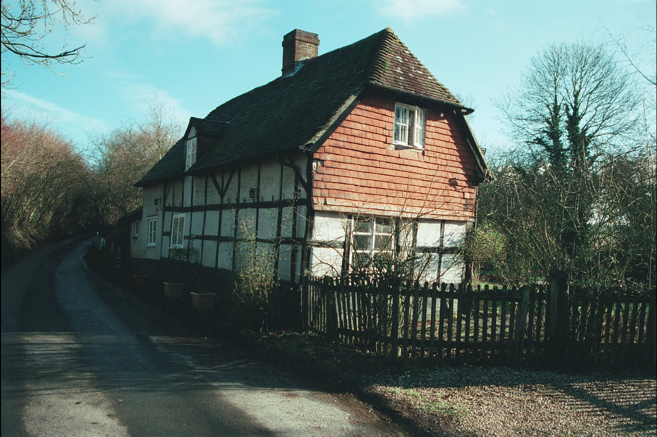
Puddle Wharf Cottage - Late 16 century, with 18 century alterations
and 20 century additions. The fireplace beam has 1753 scratched on
it. This is reputedly one of the blanket weaver's cottages after
which Weaver's Lane is named.
The First Edition Ordnance Survey
mapping marks 'Puddle Wharf Cottage', although this name is
written close to a building centred at SU 3619 6452 which was
demolished in the mid to late 20th century. This house was in an
adjacent plot to the extant 'Puddle Wharf', and a small stream
ran along their southern boundaries, down from Daggs Gully. It
is suggested that a mill existed on the opposite side of the
road known as Weavers Lane, although it is not clear what
industrial activity the water power was used for. Both the
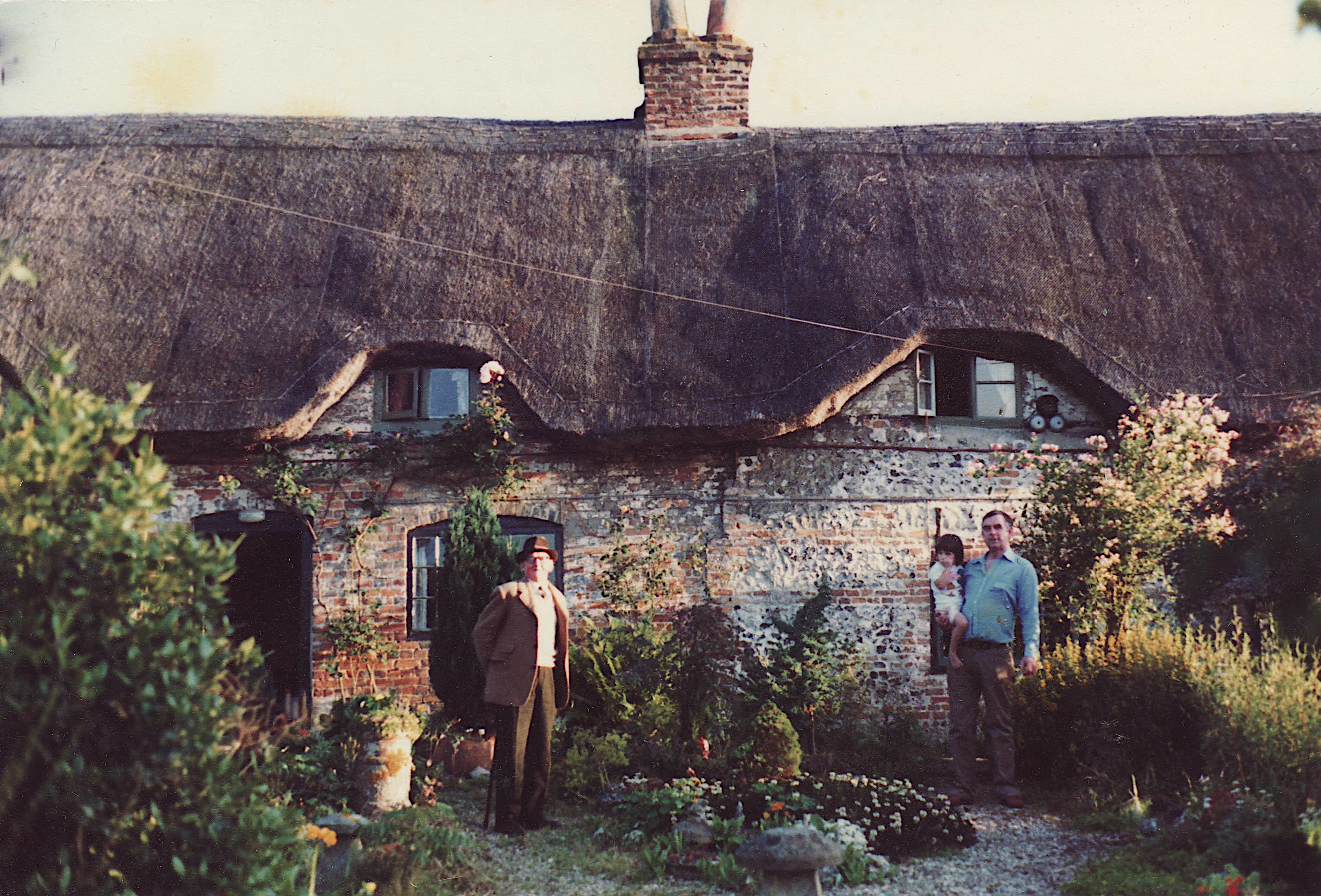
listed 'Puddle Wharf' and the adjacent cottage that burnt down
were depicted in a 1889 watercolour by Lucy Butler, the vicar's
daughter.
Lower Green
Box Cottage
Land Ownership - see Maps
Land Geology
Summary by David Russell
List of Wildlife sites in Inkpen
SSSI - Sites of special scientific interest in
Inkpen
|
Inkpen and Walbury Hills |
|
|
Inkpen Crocus Field |
|
|
Combe Wood |
|
|
Inkpen Common |
|
|
Irish Hill Copse |
|
|
Lardon Chase |
|
|
West Woodhay Down |
|
|
Hogs Hole |
|
|
Kennet and Lambourn Floodplain |
|
|
Kennet Valley Alderwoods |
Reading and District Natural History
Society - field trip report of 7th March 2009, led by Jan
Haseler, details are here.
Back to Contents List